
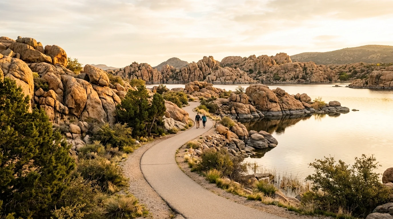
Prescott has over 250 miles of trails within a 25-mile radius — but not all of them are right for every body. Dr. Price's personal guide to trails for beginners, intermediate hikers, and trail veterans, with the medical reasons each one earns its spot.
Patients ask me almost every week which Prescott trails I recommend. The honest answer is: it depends on you. The trail that's perfect for a 72-year-old new to hiking is not the same trail that suits a 55-year-old training for a half marathon. The trail you love in March is not the trail you should be on in July.
So instead of a generic "top 10" list, here's a doctor's guide to Prescott trails — sorted by what your body can handle, with the medical reasons each trail earns its spot.
If you haven't already, read our companion piece on low-impact exercise for Prescott retirees. The principles there inform everything below.
Key Takeaways
- The Prescott National Forest contains over 450 miles of trails; the city's in-town trail system adds another 60+ miles
- Match the trail to your current fitness — not the fitness you had five years ago. Falls cause 1 in 4 emergency department visits in adults 65+
- Elevation gain matters more than distance for cardiac stress — a flat 4-mile walk and a 1.5-mile climb up Thumb Butte are not the same workout
- The best trail is the one you'll actually do twice a week, year-round
For Beginners: The Trails I Send Patients to First
1. Watson Lake Loop (Easy)
Distance: about 4.7 miles around the lake. Elevation gain: minimal — under 200 feet. Surface: mixed dirt, granite, and some short scrambles in the Granite Dells section.
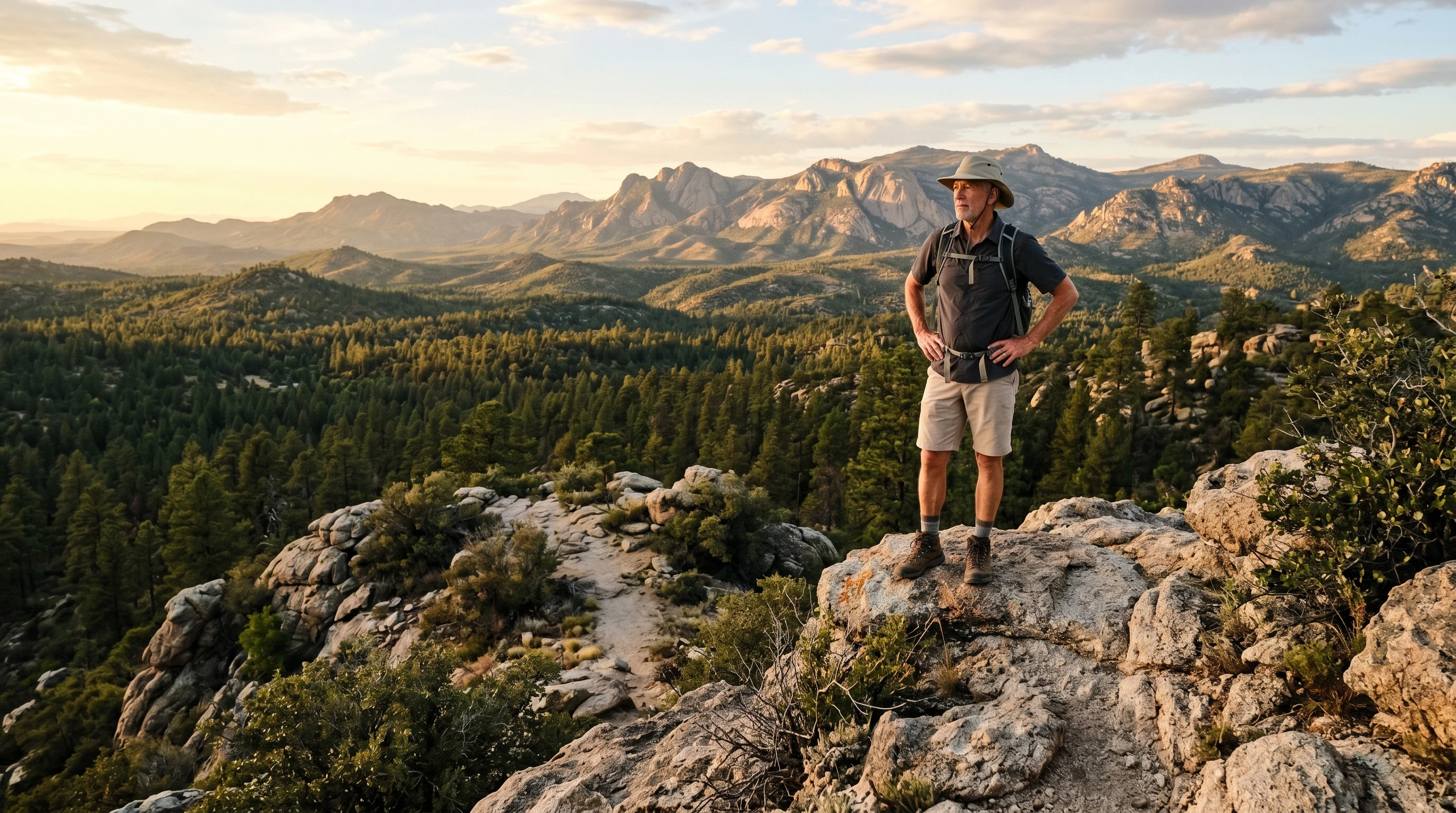
Why I love it: Watson Lake is the trail I recommend most often for newer hikers, post-surgery patients regaining fitness, and anyone with cardiac history clearing for graded exercise. The loop has bailout points throughout — if you're tired at mile 2, you're never far from a parking lot.
Medical fit: Excellent for cardiovascular conditioning without the joint impact of trail running. The granite scrambling sections are short enough to be optional. Bring trekking poles if balance is a concern.
2. Peavine Trail
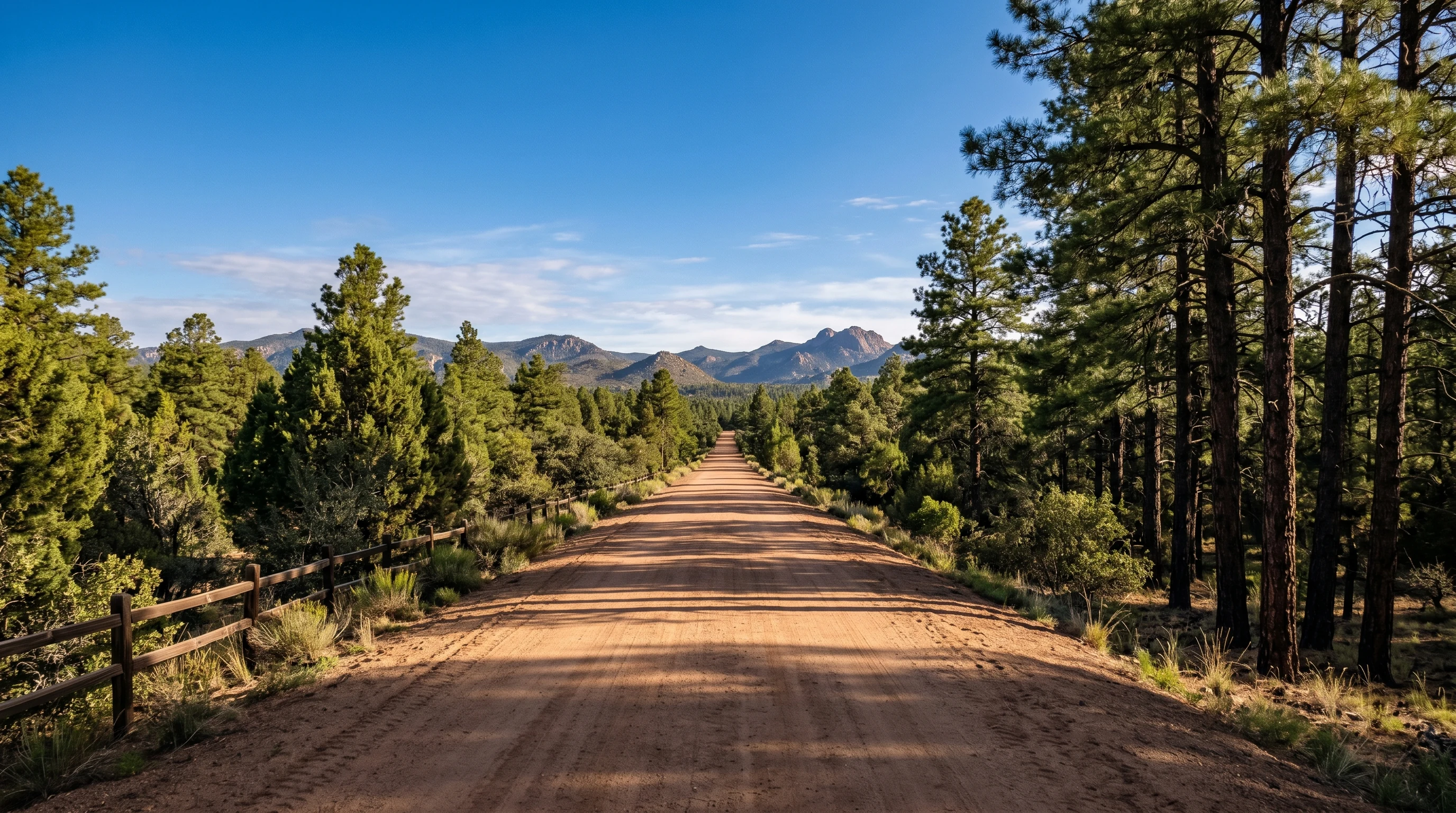
Distance: as long as you want — the rail-trail runs about 6 miles each way. Elevation gain: nearly flat (it's a former rail bed). Surface: smooth, hard-packed.
Why I love it: This is the most accessible trail in Prescott. Smooth, wide, gradual. It's the trail I send people to when they're getting back on their feet after an injury, when balance is a concern, when they need a workout that's predictable, or when their grandkids are visiting and the kids need to keep up.
Medical fit: Wheelchair- and stroller-accessible in long sections. Excellent for older adults newly starting an exercise routine. Connects to the Iron King and Prescott Circle trails for longer days.
3. Goldwater Lake Loop
Distance: about 1.5 miles around the lake. Elevation gain: minimal. Surface: mostly dirt path with some packed gravel.
Why I love it: A genuinely short, beautiful loop. I send patients here when they need a daily walking habit and don't want to commit to anything intimidating. The lake is pretty enough that you'll come back.
Medical fit: Ideal for the first few weeks of post-cardiac rehab walking, balance recovery, or people new to outdoor exercise. Easy to do in 30-45 minutes.
For Intermediate Fitness: When You're Ready for More
4. Thumb Butte Trail #33
Distance: 1.9-mile loop. Elevation gain: about 600 feet. Summit elevation: roughly 6,440 feet. Surface: paved/cement on lower sections, dirt and rock above.
Why I love it: Thumb Butte is Prescott's signature short hike. The first portion is paved and steep — it's a real cardiovascular workout. The summit views are worth the burn. Prescott National Forest manages this one.
Medical fit: Good "graduated test" trail for intermediate hikers. The paved lower section is helpful for people working back into trail effort. Note: at 6,440 ft summit elevation, the air is meaningfully thinner than central Prescott — pace yourself if you're newly arrived from sea level.
5. Lynx Lake Loop (Roundtrip)
Distance: about 2.4 miles around the lake. Elevation gain: modest, ~150 ft. Surface: mostly dirt with rocky sections.
Why I love it: Beautiful pine-shaded trail with a real Forest Service feel. The water is calming, the loop is short enough to do midweek, and the parking is easy.
Medical fit: Good intermediate option. Some rocky sections demand attention but nothing technical.
6. Constellation Trails
Distance: a network of loops from 1 to 5+ miles depending on selection. Elevation gain: rolling, modest. Surface: dirt singletrack.
Why I love it: These trails wind through pine forest with relatively gentle grades. Mountain bikers love the Constellation system, but it's plenty walkable. Pick your distance based on the day.
Medical fit: Excellent for the "intermediate plateau" — people who've outgrown beginner trails but aren't ready for sustained 1,500+ ft climbs.
For Trail Veterans: Earning Your Trails
7. Granite Mountain Trail #261
Distance: 7.9 miles out-and-back to the saddle, longer to the summit. Elevation gain: 1,663 ft. Elevation range: 5,634-7,082 ft. Surface: dirt singletrack with rocky sections.
Why I love it: Granite Mountain is the real deal. Long, sustained climb, beautiful Ponderosa pine forest, dramatic granite views, and quiet weekday trail conditions. Arizona Highways recommends starting early — they're right.
Medical fit: This is a legitimate workout. Good for fit hikers in the 50-70+ range who maintain regular cardio. Not a first-time-on-this-trail summer afternoon hike — start before 7 a.m. in summer, bring more water than you think (1 liter per hour plus an extra liter for elevation gain), and be off-summit before monsoon storms build.
8. The Prescott Circle Trail (Sections)
Distance: 56 miles total around the city. Elevation gain: cumulative thousands. Most people do it in segments.
Why I love it: This is Prescott's bucket-list trail system — a full circumnavigation of the city via trail. Most patients don't do the whole thing in a season (or a lifetime), but knocking out segments is a fantastic way to build durable, varied fitness.
Medical fit: For experienced hikers who want a long-term project. Match each segment to your fitness; the difficulty varies dramatically.
9. Granite Basin Recreation Area
Distance: multiple loops 2-7 miles. Elevation gain: varies. Surface: dirt and rock.
Why I love it: Granite Basin is the trailhead for some of Prescott's best singletrack — including the Granite Mountain trail and a network of intermediate loops. The Granite Basin Lake area is beautiful and the parking is straightforward.
Medical fit: A great place to mix and match. Pick a 3-mile loop on a recovery day and a 7-mile combo on a stronger day.
How to Pick the Right Trail Today
Here's the framework I walk patients through:
- Match the trail to today's body, not your peak. If you slept badly, ate poorly, or have any new symptoms — choose easier than your usual.
- Elevation gain matters more than distance. A flat 4-mile walk and a 1.5-mile climb up Thumb Butte produce very different cardiac stress.
- Time of day matters as much as the trail. Watson Lake at 7 a.m. in July is heavenly. The same trail at 2 p.m. is a heat illness risk.
- Build slowly. Add ~10% per week to either distance or elevation gain. If something hurts, back off and rebuild.
- Hydration starts the day before. See our hydration article for specifics.
And read the summer hiking safety guide before any heat-season trip — heat illness, snake encounters, and monsoon flash floods are all real risks worth respecting.
Trails I Send Patients to with Specific Conditions
- Recent cardiac event or new exercise after long sedentary period: Peavine Trail or Goldwater Lake. Easy to bail out, predictable, low elevation gain.
- Knee or hip osteoarthritis: Peavine for length, Goldwater for short daily walks. Avoid technical descents.
- Balance concerns or fall history: Peavine. Bring trekking poles. Skip Granite Dells scrambles.
- Working on aerobic fitness without joint impact: Watson Lake Loop or Lynx Lake.
- Cardiopulmonary conditioning building toward a goal hike: Thumb Butte once a week as a graduated test.
- Visiting from sea level for a weekend: Stick to easy/intermediate the first 24-48 hours; save Granite Mountain for day 3.
What Trails Have to Do With DPC
I'll make this brief. Most primary care visits don't have time to talk about trails. That's not a critique — it's the reality of how insurance-based primary care is structured. A 7-minute visit can address one acute issue, refill a prescription, or start one diagnostic workup. It can't include a real conversation about whether your knees are ready for Granite Mountain.
In our Direct Primary Care model, we have time to talk through specifics. What hurts after which trails. Whether your blood pressure response to elevation gain has changed. Which medication might be making you dehydrate faster. Which trails in our area I'd actually send my own family on.
If you'd like that kind of relationship for your primary care, you can enroll as a member or call 928-515-2803. The trails will still be there. Let's make sure you can keep using them.
One Last Note
The best trail is the one you'll do twice a week for the rest of your life. Not the most scenic. Not the hardest. The one you'll keep showing up for.
For me, that's been Watson Lake more times than I can count. For some of my patients, it's a 30-minute Goldwater loop they walk every morning. For others, it's a Saturday Granite Mountain ritual. The medicine works the same. Find yours.
Frequently Asked Questions
What's the easiest trail in Prescott for beginners?
The Peavine Trail is the most accessible trail in Prescott — a smooth, wide, nearly flat former rail bed that's wheelchair- and stroller-accessible in long sections. It's the trail Dr. Price recommends most often for patients new to exercise, recovering from injury, or with balance concerns. Goldwater Lake Loop (about 1.5 miles around the lake) is another excellent beginner option for daily walking habits.
Is Thumb Butte Trail too hard for older hikers?
It depends on your fitness. Thumb Butte Trail #33 is a 1.9-mile loop with about 600 feet of elevation gain — short but genuinely steep. The lower paved section is helpful for working back into trail effort, but the climb is a real cardiovascular workout. The summit sits at roughly 6,440 feet, where the air is noticeably thinner than central Prescott. It's well-suited to intermediate-fit hikers and serves as a 'graduated test' trail for building toward longer climbs.
How do I pick the right trail for my fitness level?
Match the trail to your current fitness — not your peak fitness from years ago. Pay attention to elevation gain more than distance (a flat 4-mile walk and a 1.5-mile climb up Thumb Butte produce very different cardiac stress). Build slowly, adding about 10% per week to either distance or elevation gain. Time of day matters as much as the trail itself — early-morning hikes are far safer in summer. If you slept badly, ate poorly, or have any new symptoms, choose easier than your usual.
What's the longest hike in Prescott?
The Prescott Circle Trail is a 56-mile system that fully circumnavigates the city. Most people complete it in segments over months or years rather than in one push. Within the Prescott National Forest, Granite Mountain Trail #261 is one of the most challenging single hikes — 7.9 miles out-and-back with 1,663 feet of elevation gain, climbing from 5,634 to 7,082 feet. Always start early and carry plenty of water (about 1 liter per hour plus an extra liter for elevation gain).
Are Prescott trails safe in summer?
They can be, with proper planning. Heat illness, dehydration, snakes, and monsoon flash floods are all real summer risks. Hike before 7 a.m. on hot days, be off exposed trails by noon during monsoon season (mid-June through September), bring more water than you think you'll need (about 1 liter per hour at altitude plus extra for elevation gain), wear sun protection, and stick to closed shoes on rocky terrain. Read our summer hiking safety guide for full evidence-based recommendations.